GNSS
eRTK10
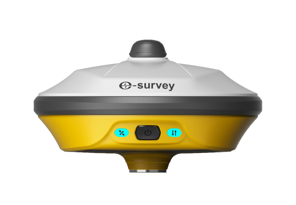
With the advanced AR visual positioning technology, the eRTK10 enables faster stakeouts and significantly improves overall working efficiency. Its compact design makes it convenient to carry in various complex environments.

With the advanced AR visual positioning technology, the eRTK10 enables faster stakeouts and significantly improves overall working efficiency. Its compact design makes it convenient to carry in various complex environments.


The eRTK10 GNSS receiver is equipped with advanced AR visual positioning technology, which offers an immersive 3D stakeout experience in real-world environments. With a highly accurate visual reference, the eRTK10 enables faster stakeouts and increases productivity.

The eRTK10 features a compact design that makes it easy to carry around in various complex environments. It is lightweight and can be taken to any location, offering high-precision performance where needed.

The eRTK10 is integrated with an internal radio (Rx only) and a 60° inclination IMU function, making it a perfect choice for any rover station scenario. It also helps improve accuracy and performance.
With the cutting-edge Web UI, users can effortlessly access and manage the eRTK10’s position status, configure working modes, retrieve data, and perform firmware updates using a smartphone, tablet, or PC.
The product has a sturdy design that is certified as IP68. This means it can withstand tough environments without any worry. It is both dust-tight and protected against the effects of continuous immersion in water.
The product boasts of being equipped with multi-constellation and multi-frequency capabilities. This enables it to track GNSS signals from various satellites with utmost precision and reliability. With a whopping 1408 channels for GNSS tracking, it guarantees an accurate performance. It supports all GNSS signals including GPS, BDS, GLONASS, GALILEO, QZSS, SBAS, L-Band, and NavIC in compliance with industry standards.
Lorem ipsum dolor sit amet, consectetur adipiscing elit. Nullam condimentum arcu quis est cursus, et vehicula mauris mattis. Maecenas ultrices feugiat tellus non accumsan.
Satellites tracking
Channels: 1408
Cold start: < 30 seconds
Warm start: < 20 seconds
Hot start: < 5 seconds
RTK signal initialization: < 5 seconds
Initialization reliability: > 99.9%
Update rate: 20 Hz
High precision static: H: 2.5 mm + 0.1 ppm RMS V: 3.5 mm + 0.4 ppm RMS
Static and Fast Static: H: 3 mm + 0.5 ppm RMS V: 5 mm + 0.5 ppm RMS
RTK: H: 5 mm + 0.5 ppm RMS V: 10 mm+0.5 ppm RMS
Standard point positioning: H: 1.5 m RMS V: 2.5 m RMS
Code differential: H: 0.4 m RMS V: 0.8 m RMS
SBAS: H: 0.3 m RMS V: 0.6 m RMS
Correction data: RTCM V3.X, RTCM2, CMR
Data output: GGA, ZDA, GSA, GSV, GST, VTG, RMC, GLL, Binary
Smart Control
Smart Control
Optical
Optical
Optical